Forever Wild
Collaborating with private landowners on land protection is an essential tool for conservation
Why Protect Private Land?
Wisconsin has many beautiful natural areas, many of which are protected in state and county parks, wildlife areas, state natural areas, and national forests. However, some special places have amazing scenic beauty and rare plants and animals but are in private ownership. These are the places that conservation organizations like Landmark Conservancy focus on for land protection. Landmark Conservancy protects land across 20 counties in northwest and west Wisconsin. Its main office is in Menomonie, WI, with a satellite location in Bayfield, WI.
"When we consider purchasing land for conservation, we are thoughtful about the properties we choose," says Erika Lang, Landmark Conservancy's Conservation Manager in the Bayfield office. "In most cases, the land is really special, and the community has already identified the property as a wonderful place to connect with nature. The attributes might be rare ecological values, high water quality, recreation opportunities, or very large properties that connect to other protected properties and help support species that need large blocks of habitat."
"State and federal funding sources are essential for this type of land protection across Wisconsin and elsewhere," says Lang. "Consistency in funding is important, which federal funding sources like the U.S. Fish and Wildlife Service and the Great Lakes Restoration Initiative (GLRI) have provided. Private grants also play a role but are sometimes shorter-term, and the funders may shift their focus away from conservation over time. Reliable funding is needed to sustain Landmark's ability to purchase special lands for conservation. In fact, most of our work is not focused on purchasing land but rather helping landowners establish conservation easements on their own properties so that those lands are protected from development in perpetuity. They still own the land, manage it, pay taxes, and are responsible for it; the easement helps guide what happens on the land."
Questions have arisen about why we need more protected land, especially in northern Wisconsin where large tracts of public land already exist in county and national forests.
"Even though it happened over 100 years ago, the land is still healing following the Great Cutover, when almost all of Northern Wisconsin's forests were stripped of trees," says Lang. "Now we have additional threats — land development, larger floods, forest pests, a changing climate. We need to continue to protect ecologically intact properties as a first step to build more resiliency. With this foundation laid, we can focus our resources on doing restoration and enhancement activities. There are many ecological and scenic gems in private hands and some of those landowners want to ensure that those qualities are preserved in perpetuity while sharing the land with the public. When we purchase these types of properties, it's a win-win for the landowners and the public. We often work with conservation partners to do these projects, sometimes even transferring the property to a local government partner for long-term ownership and management."
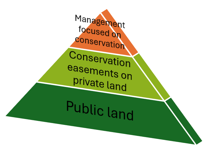
Figure 1. Public investment in conservation-focused management rests on a strong foundation of land that is permanently protected, both public and private lands.
"Public land is so important for the quality of life here in Bayfield County. We need to save the unique places that we have in our community," says Sara Hudson, Recreation Coordinator, Bayfield County Forestry and Parks. "Some land isn't suitable for intensive development and is better suited for outdoor recreation like hiking, hunting, fishing, and birdwatching. A lot of unique places are privately owned, and the landowners want to protect them for future generations."
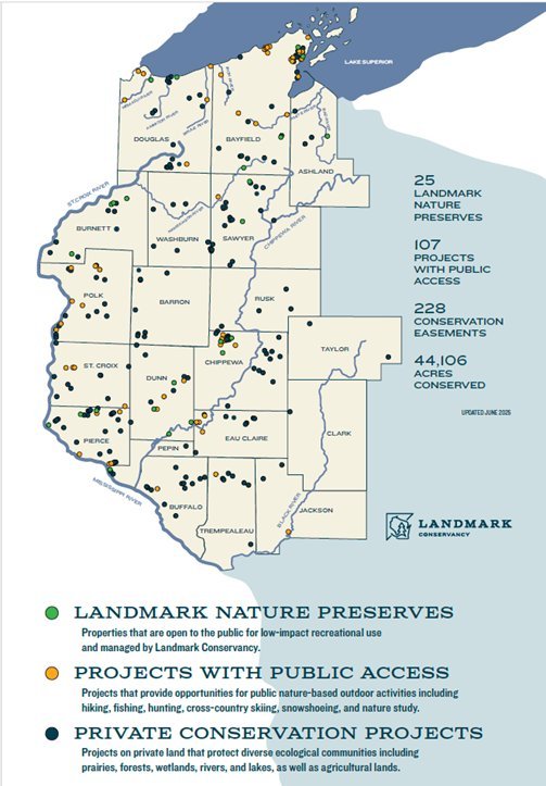
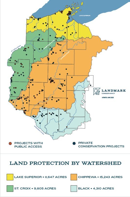
Map of Landmark Conservancy protected lands, 2025 (left) and land protection by watershed (right).
Knowles-Nelson Stewardship Fund
In Wisconsin, the Knowles-Nelson Stewardship Fund has funded millions of dollars of conservation projects since 1989, but the political will to continue to fund the program has faltered in recent years. "It will be devastating for the public if the state doesn't renew the Knowles-Nelson Stewardship Fund," says Lang. "The program pays for a lot of upgrades to state parks and wildlife areas, as well as supporting land purchases initiated by the DNR, local governments, and non-profit organizations like land trusts. We (Landmark Conservancy) would not have been able to complete some of our best conservation projects without this funding. These protected places are loved by the public, but many people are not aware that Knowles-Nelson made it possible."
"Knowles-Nelson assists with land acquisitions for public access and then improvements to properties to enhance recreation," says Hudson. "Knowles-Nelson helped pave the way to establish two significant recreation areas in Bayfield County — Fire Hill Preserve and Lost Creek Falls — as well as areas in nearby counties."
Examples of Land Protection Projects in Bayfield and Ashland Counties
Fire Hill Preserve
Fire Hill Preserve, Bayfield County Forestry and Parks. Entrance photo by Erika Lang.
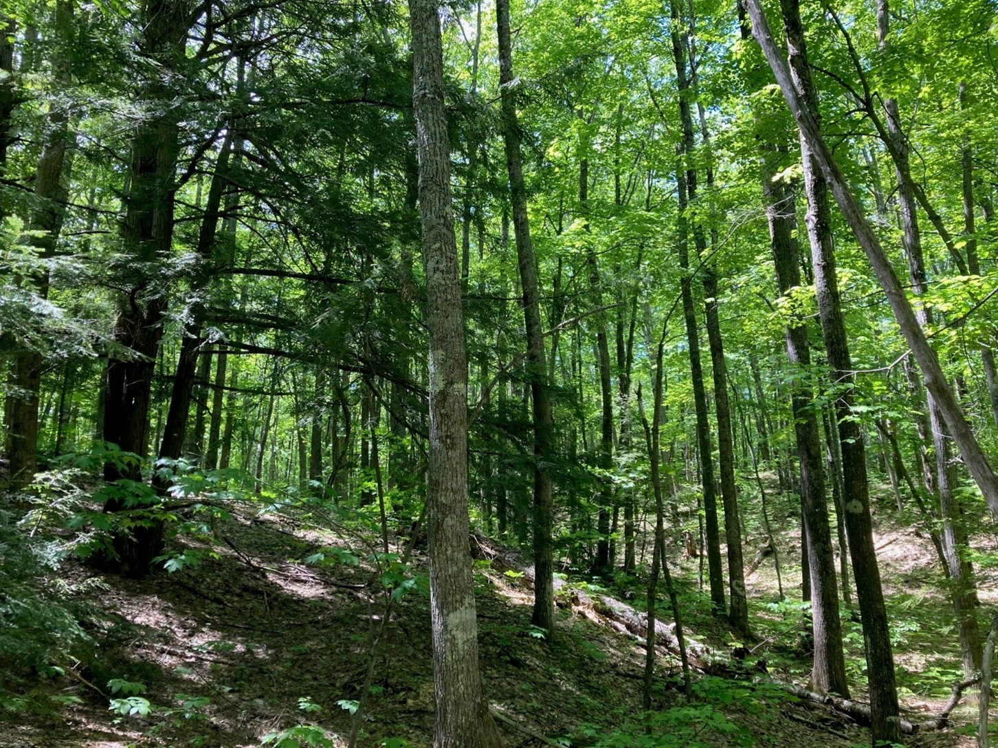
Fire Hill Preserve is a 107 acre preserve just outside of Bayfield, WI, in the "fruit loop". This unique property was initially platted as a housing development, but thanks to the help of Landmark Conservancy it was acquired for conservation and public outdoor recreation. The property has steep topography with primarily mature oak and red maple, with some hemlock and beautiful young birch stands. Non-motorized outdoor recreation opportunities are currently being planned for this space. Funding for the $171,840 purchase came from the Wisconsin Knowles-Nelson Stewardship Program and Wisconsin Coastal Management Program in 2019.
Lost Creek Falls Special Management Area (SMA)
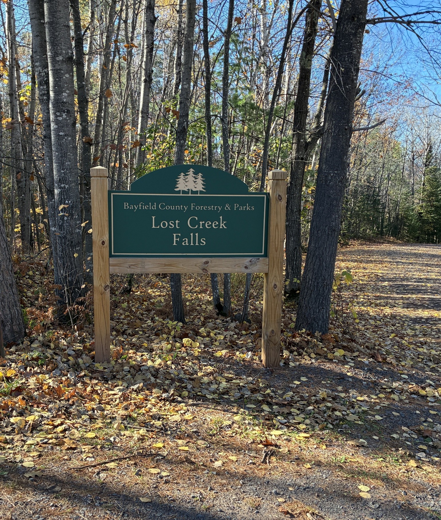
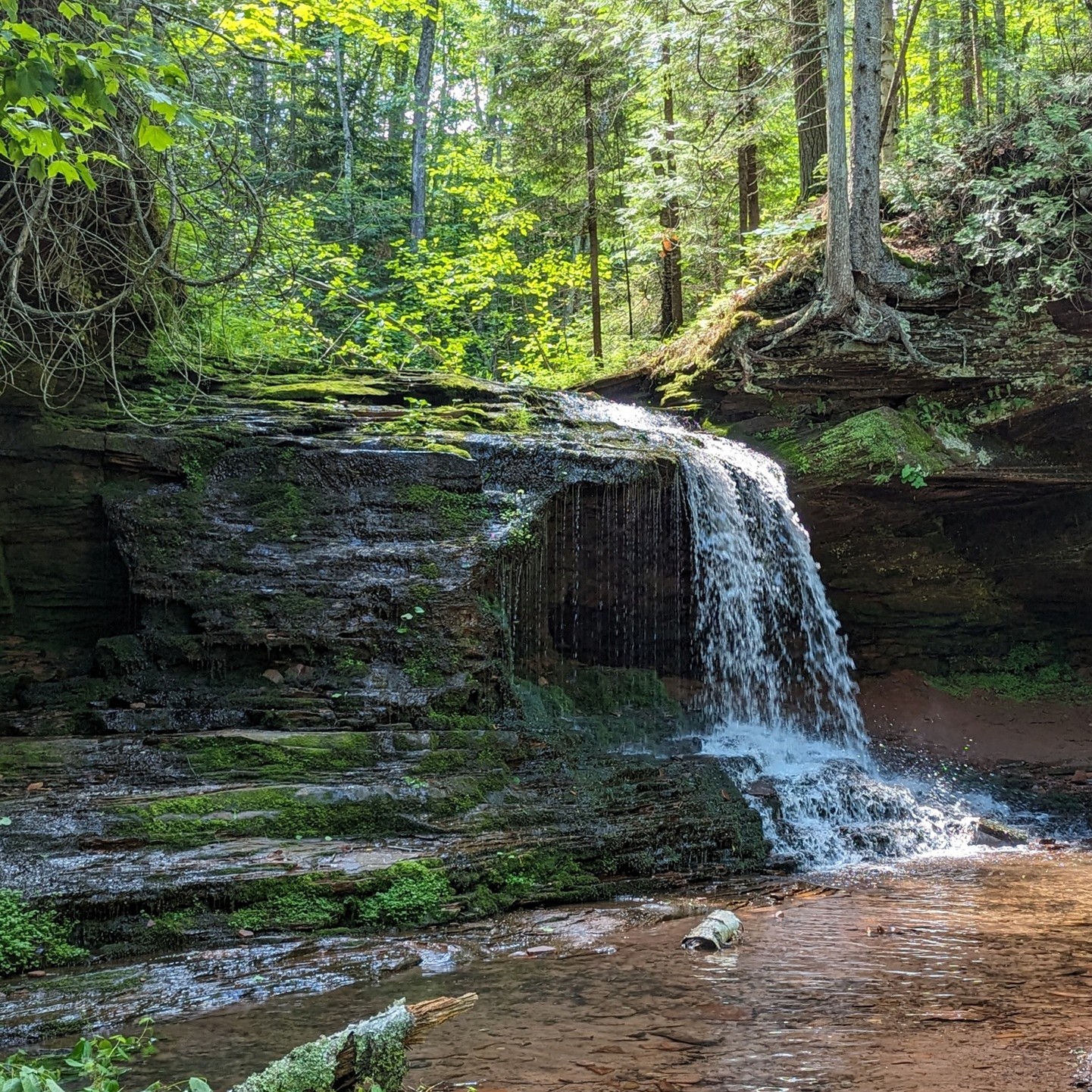
Entrance to Lost Creek Falls (left) and Lost Creek Falls (right), Bayfield County. Waterfall photo by Lindley Mattson.
The Lost Creek Falls SMA is located just south of Cornucopia and comprises roughly 420 acres and includes Lost Creeks — Numbers 1, 2, and 3. The Lost Creek Falls hiking trail, on Lost Creek Number 1, is a 1.25-mile hike to the largest of the waterfalls, Lost Creek Falls. The Lost Creek Falls Trail exists among an abundance of large, 100+ year old red and white pines, as well as steep, V-shaped drainages, some more than 100 feet deep. The trail meanders through County Forest land before reaching a series of waterfalls, including one on Lost Creek Number 1 that you can walk behind. Landmark Conservancy and Bayfield County worked together to purchase 160 acres in the headwaters of the SMA with the help of Knowles-Nelson Stewardship funding in 2022.
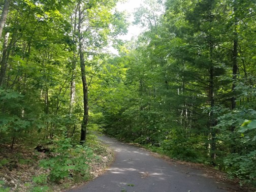
Tyler Forks Community Forest
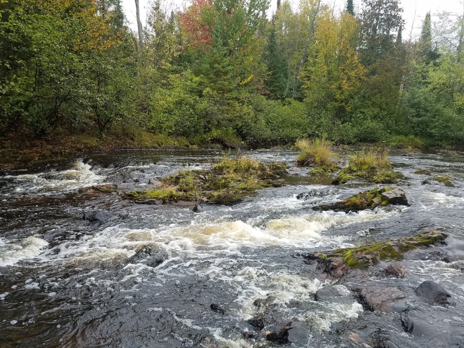
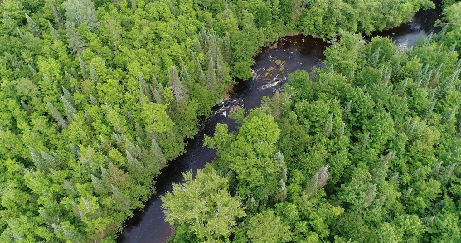
Tyler Forks Community Forest, Ashland County. Drone photo by Roger Aiken; river photo by Erika Lang.
In 2019, Landmark Conservancy purchased just under 600 acres on the east side of Copper Falls State Park in Ashland County for $719,650 from a family that had owned it since the 1990s. Since purchasing the property, Landmark has established an extensive trail system with connections to the state park, allowing more hiking, snowshoeing, skiing, and access to the trout waters of the Tyler Forks and its tributary Scott Taylor Creek. Funding came from Wisconsin's Knowles-Nelson Stewardship Program and the U.S. Forest Service's Community Forest and Open Space Program.
Outlook for the Future
Despite shifts in funding, both Lang and Hudson are optimistic about the future. "The Lake Superior Collaborative and other partner organizations are working to conserve the land in the area," says Hudson. "We also have many community members who recognize the importance of this amazing place that we call home. The County has a few new projects in the development phase. They include the Iron River Community Forest, the Jerry Jolly Trail System, and Big Rock County Park."
"As long as we have great partners to help fund our work like the U.S. Fish and Wildlife Service, GLRI, Knowles-Nelson Stewardship Program, and others, we'll respond to inquiries and have conservation stories to tell," says Lang. "A lot of landowners are aging and thinking about next steps. That gives us an opportunity to work with them on leaving a conservation legacy for the greater good."